Tuesday, October 23, 2012
Renaming the blog
This blog was created for my hike of the Continental Divide Trail. As I have decided to keep posting my other adventures, "CDT 2012" will no longer do. The new name is a reference to my favorite song, "I don't mind" by the Tobasco Donkeys (which is based around several Edward Abbey quotes).
Blanca Lake, Mt. Rainier, and Mt. Shuksan
The northwest had a wonderfully clear September, which made for great end-of-summer adventures.
Blanca Lake
I have been meaning to hike to Blanca Lake since seeing a friend's photos a couple years ago. I was not disappointed--the weather was clear and the lake was a brilliant turquoise.
Mt. Rainier
The weather was agreeable for an end of summer climb of Mt. Rainier. This was my fourth climb and second summit.
Mt. Shuksan
At 9,131', Mt. Shuksan is Washington's ninth highest peak. It is a fantastic climb--not so high as to cause altitude problems, a pretty approach hike, a few crevasses, and a rock scramble to the top.
Blanca Lake
I have been meaning to hike to Blanca Lake since seeing a friend's photos a couple years ago. I was not disappointed--the weather was clear and the lake was a brilliant turquoise.
 |
| Blanca Lake's signature color |
The weather was agreeable for an end of summer climb of Mt. Rainier. This was my fourth climb and second summit.
 |
| On the way up to Camp Muir |
 |
| Ice axe self-arrest practice |
 |
| Setting up the belay system for crevasse practice |
 |
| Practicing crevasse rescue |
 |
| Sunrise over Mount Tahoma |
 |
| A successful climb |
Mt. Shuksan
At 9,131', Mt. Shuksan is Washington's ninth highest peak. It is a fantastic climb--not so high as to cause altitude problems, a pretty approach hike, a few crevasses, and a rock scramble to the top.
 |
| Camped on the glacier |
 |
| Mt. Baker from camp |
 |
| Attempting to get an early start |
 |
| Crevasses below the summit pyramid |
 |
| On top |
 |
| Harrison rappelling down from the top |
 |
| Mountain goat |
Monday, August 13, 2012
A Road Trip and a Conclusion
In 2006, there were two sections of the PCT that were closed due to fire. A couple weeks ago I went on a road trip in an attempt to make them up.
I started in Sisters, Oregon to hike 17 miles between McKenzie and Santiam Passes. I completed it in a day before heading to Bend to visit friends from the PCT.
My plan was to then hike a section in the Marble Mountain Wilderness, near Etna, California. Unfortunately, road construction made the shuttle between endpoints prohibitively long, so I headed over to Mt. Shasta. I hiked up the 14,179' peak via the Clear Creek Route.
I hoped to climb Lassen Peak while in the area, but the trail was closed for maintenance. This allowed me to spend more time in Sebastopol with another PCT friend and his wife. We went into San Francisco and then out to the coast, where there were whales within a couple hundred yards of the shore.
On the way north, I spent the night in the redwoods before visiting friends in Eugene and Portland.
Finally, I will not be returning to the CDT. I have been waiting for the day when I wake up with an itch to get back on the trail, but that has not happened. Right now, I do not have the deep drive the trail requires. My only regret is that I will not be able to spend more time hiking with the good friends I made along the way; the trail itself will always be there. I would like to thank everyone who supported me along the way and helped me learn about myself and what I value.
My next adventure will hopefully be non-adventure. Living out of a duffle bag or backpack for the last couple years has been a valuable experience, but I think I am ready to be in my own bed at the end of most days.
I started in Sisters, Oregon to hike 17 miles between McKenzie and Santiam Passes. I completed it in a day before heading to Bend to visit friends from the PCT.
 |
| On the PCT, Mt. Washington in the background. |
My plan was to then hike a section in the Marble Mountain Wilderness, near Etna, California. Unfortunately, road construction made the shuttle between endpoints prohibitively long, so I headed over to Mt. Shasta. I hiked up the 14,179' peak via the Clear Creek Route.
 |
| The summit of Mt. Shasta. |
I hoped to climb Lassen Peak while in the area, but the trail was closed for maintenance. This allowed me to spend more time in Sebastopol with another PCT friend and his wife. We went into San Francisco and then out to the coast, where there were whales within a couple hundred yards of the shore.
 |
| Crossing the Golden Gate Bridge. |
On the way north, I spent the night in the redwoods before visiting friends in Eugene and Portland.
 |
| The Tall Trees Grove after camping along Redwood Creek. |
 |
| Hiking through the Lady Bird Johnson Grove as the fog was breaking. |
Finally, I will not be returning to the CDT. I have been waiting for the day when I wake up with an itch to get back on the trail, but that has not happened. Right now, I do not have the deep drive the trail requires. My only regret is that I will not be able to spend more time hiking with the good friends I made along the way; the trail itself will always be there. I would like to thank everyone who supported me along the way and helped me learn about myself and what I value.
My next adventure will hopefully be non-adventure. Living out of a duffle bag or backpack for the last couple years has been a valuable experience, but I think I am ready to be in my own bed at the end of most days.
Sunday, July 22, 2012
My last few weeks
I have been having a great time since coming home from the trail. Here are a few photos.
I am heading out tomorrow down to Oregon and northern California to make up two sections of the PCT that I missed in 2006. I will be visiting friends along the way, and hope to climb Mt. Shasta and Lassen Peak while I am down there. Clement will be finishing northern Montana in the second half of August. I hope to join him for that stretch, assuming I have not softened up too much during my time home to be able to keep up.
I am heading out tomorrow down to Oregon and northern California to make up two sections of the PCT that I missed in 2006. I will be visiting friends along the way, and hope to climb Mt. Shasta and Lassen Peak while I am down there. Clement will be finishing northern Montana in the second half of August. I hope to join him for that stretch, assuming I have not softened up too much during my time home to be able to keep up.
 |
| Atop Mt. Townsend in the Olympic Mountains. |
 |
| Sunset over the Straight of Juan de Fuca from Mt. Townsend. |
 |
| Scrambling up a pinnacle near the top of Guye Peak. |
 |
| Trillium in bloom near Snoqualmie Pass. |
 |
| A new bulletin board for camp. |
 |
| The pier at camp. |
 |
| Oregon dunes. |
Wednesday, June 27, 2012
A change in plans
It has been a while since my last post because I have been uncertain how to announce that I have changed my CDT plans.
After two months and ~950 miles, I returned home a couple weeks ago after realizing that a true, five month continuous thru-hike was not the right thing for me to be doing to be happy, as I badly missed friends, family, and favorite non-hiking activities. I left the trail from Salida by hitching to Colorado Springs and flying back to Seattle. I arrived in time to see my brother and his family who were in town for a few days, go on a trip with friends to Oregon, and participate in the Fremont Solstice Parade. I am also helping with the sea kayaking and hiking treks and carpentry projects at the camp I used to work at.
My CDT journey is not over, however. I plan to return to hike several hundred more miles in Montana (Glacier NP, Bob Marshall Wilderness) and Wyoming (Yellowstone NP, the Wind River Range) in late July and August. For those who have not done so already, please follow the blog by entering your email to receive updates when I get back on the trail.
Saturday, June 9, 2012
Lake City to Salida
I arrived in Salida first thing Friday morning from Monarch Pass. I will head back to the trail today and should reach Leadville on Wednesday.
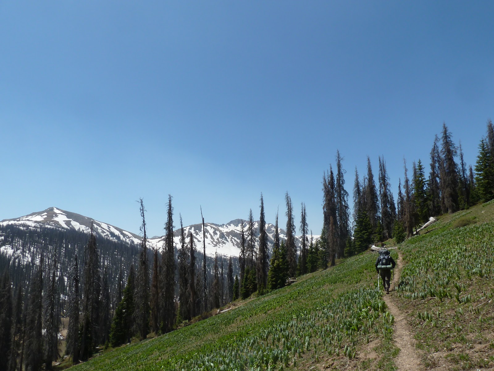
On Tuesday I climbed my first Colorado fourteener, San Luis Peak (14,014'). There was hardly any snow left on the trail and I was able to make great time, including my first 30 mile day on the CDT. Apart from trees blown down across the trail in the next section, I expect few delays and should be able to keep my mileage in the mid to high 20s from here forward.
On Tuesday I climbed my first Colorado fourteener, San Luis Peak (14,014'). There was hardly any snow left on the trail and I was able to make great time, including my first 30 mile day on the CDT. Apart from trees blown down across the trail in the next section, I expect few delays and should be able to keep my mileage in the mid to high 20s from here forward.
 |
| The last patches of snow. |
 |
| Top of San Luis Peak. It was quite windy. |
 |
| This terrain made 30 miles fairly easy. |
 |
| Hikingin east in the cool of the morning. |
 |
| Old grazing land. |
 |
| Back in aspen. |
 |
| Wildflowers scattered amongst the rock. |
 |
| Following the ridge south of Monarch Pass. |
Sunday, June 3, 2012
Lake City
Lake City is a wonderful town of ~400 year-round residents. I arrived on Friday and am staying at the Raven's Rest Hostel, owned by a thru-hiker I know from the PCT, Lucky (his trail name, and yes, he's Irish) and his wife.
Of course, like everyone wants to do after getting off the trail, the first thing I did that afternoon after a shower was help him lay 1,300 square feet of sod. It was quite satisfying, as such projects are something I miss while on the trail. I also spent part of my weekend attempting to fix an adult-sized tricycle, but after getting the internal 3-speed hub back in order, I discovered another problem that will have to wait for another mechanic.
I arrived just in time to participate in a 5/10k fun run on Saturday morning. As it was supposed to be a rest day, I opted for the 5k. I was satisfied by my time of 23:59. Lucky's wife won the women's division, breaking 22 minutes.
After two great days off, I will head back to the trail sometime tomorrow.
 |
| I finished 8th overall, out of a couple dozen. |
 |
| With Lucky and two of his very friendly dogs. |
 |
| Part of the new lawn. |
 |
| In the workshop. |
Pagosa Springs to Lake City
The hike to Lake City via Spring Creek Pass went faster than expected. I arrived in Lake City on Friday afternoon with another hiker I had been with since Pagosa Springs. He left Lake City earlier than I, so I will be solo going forward. I should be in Salida by the end of the week.
Trail conditions improved over the stretch from Chama, as the snow is melting quickly (but refreezing overnight, reducing time wasted post-holing) and the trail followed more open terrain. There was still plenty of snow, elevation change (we ranged from 10,000' to 13,000'), and downed trees, making for long days.
The CDT joined the Colorado Trail partway through the section. The difference in trail maintenance was stark: less trail rutting, almost no overgrown brush, and water bars that prevented the trail from becoming a creek.
We camped above treeline a couple times, requiring me to strap bunches of twigs to my pack to cook dinner. This made for an interesting look.
I rarely carry produce while hiking, so I was delighted when a couple ATVers I came across gave me large chunks of pineapple when I was five days along.
When Clement and I were hiking into Ghost Ranch, we visited with a couple we met along the dirt road walk. The woman is a painter and took our picture to paint later. The result can be seen here.
 |
| Snowy descent |
 |
| The snow refroze at night, making for relatively easy walking. |
 |
| We usually looked ahead at the relatively snow-free southern slopes, only to be greeted by snow on the northern exposures. |
 |
| Sunny, but cold, morning. |
 |
| Walking a snow-free ridge. |
 |
| Coming out of a low valley. |
 |
| Snack break. |
 |
| Snowy traverse. |
 |
| Elk running away. |
 |
| Dramatic topography in the middle of this section. |
 |
| Snowmelt flowing down the trail. |
 |
| The last couple days were fairly clear, going over high, rolling hills. |
 |
| View from the dinner table. |
Subscribe to:
Posts (Atom)